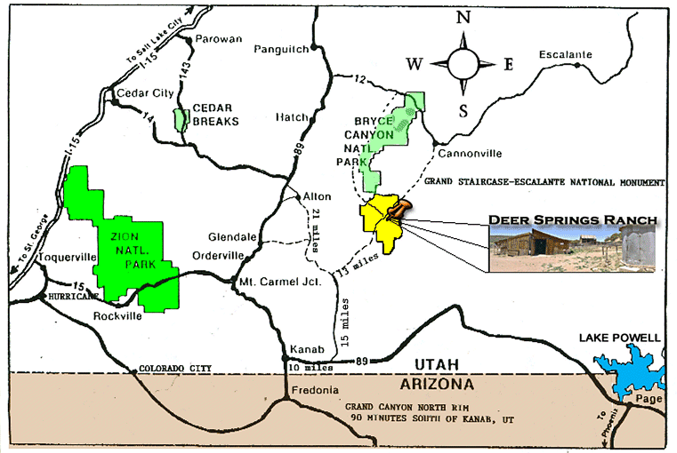
Driving Directions
Most likely you will go through Kanab, Utah on your way to the Ranch.
If you would like driving directions on how to get to Kanab
use the link on the map below:
View Larger Map
NOTE: clicking "View Larger Map" takes you to a new window.
Use you browser's Back button to return.
From Kanab you want to drive East for 10 miles on US 89
(as if you were going to Lake Powell).
You will then turn North at Johnson Canyon Road and keep going
(
15 miles
) until the paved road ends at a 3 way junction.
Turn right (northeast) on the non-paved county road.
Go 13 miles until you see the signed road to the
DSROA Headquarters on the right (south).
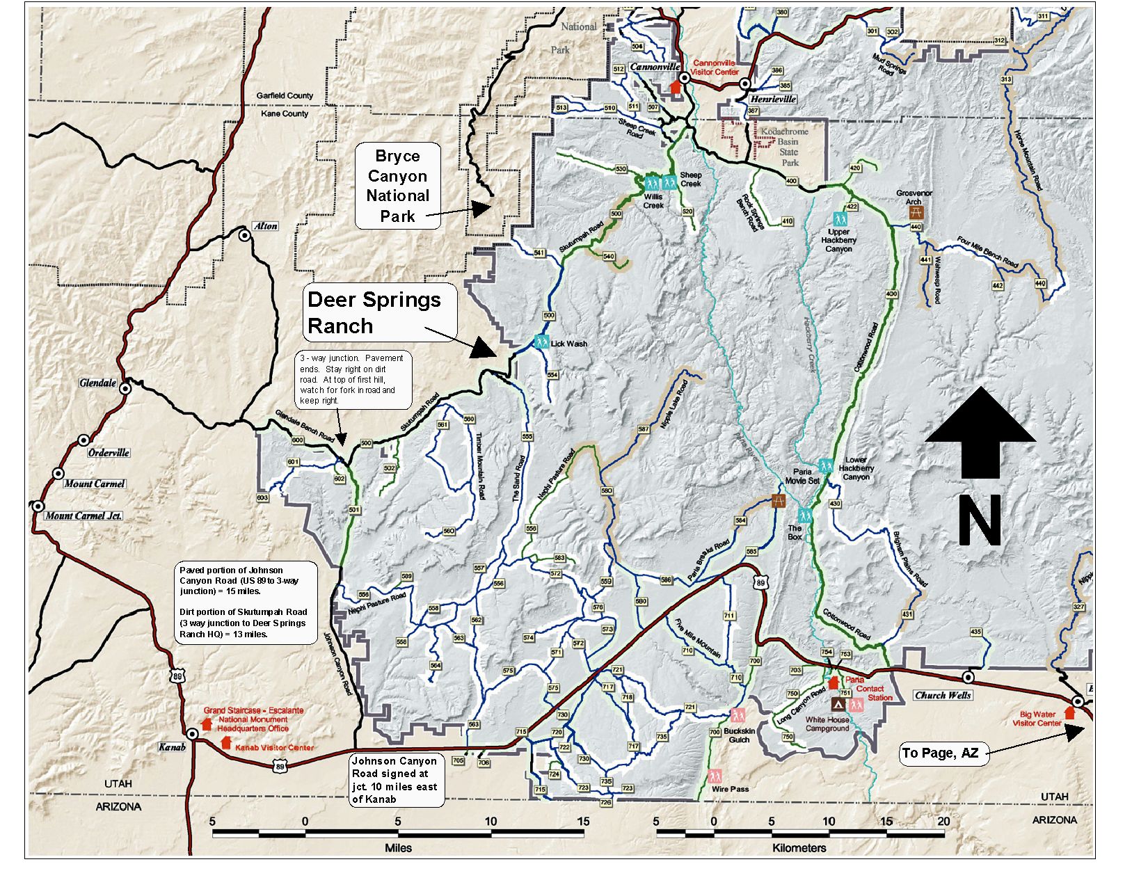
Map of Kanab / Deer Springs Ranch area
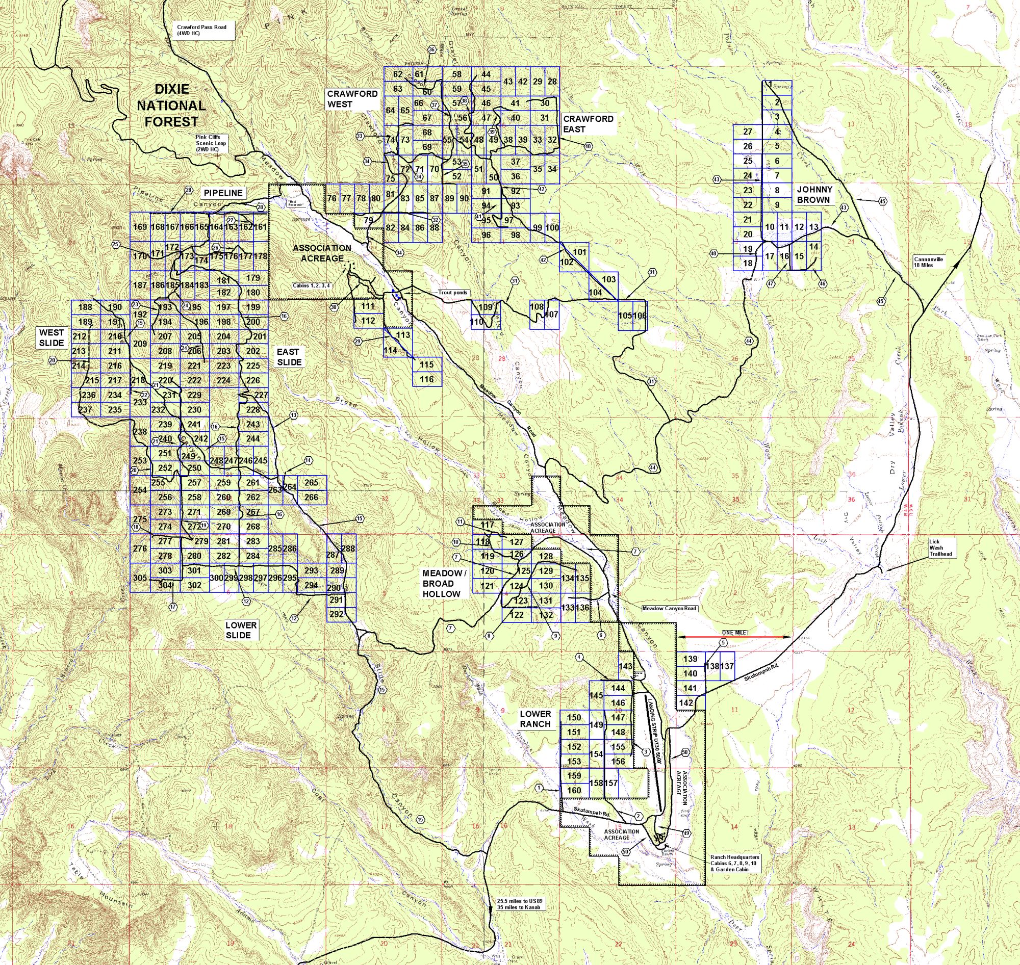
Map of Deer Springs Ranch
NOTE: Large .JPG files - may take a while to load if you have
a slow connection.
Maps are large in order to show detail - make sure you are
viewing it at 1:1 scale for best results.
Most browsers will shrink it down to fit in the screen window.
Use an imaging app like Photoshop to view it at 1:1 scale.
When you print them, they look much better.